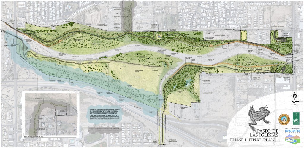
Paseo de las Iglesias Phase 1
Paseo de las Iglesias Phase 1 is a $14 million flood control, ecosystem restoration, and river park project funded by bonds approved by voters in 2004. The project is located along the Santa Cruz River and historic floodplain between Ajo Way and Silverlake Road, within two miles of downtown Tucson.
The project provides erosion and flood control using soil cement and gabions to protect existing residences, structures, and former landfill sites. The key ecosystem restoration elements include water harvesting basins, planting and seeding with a diverse native plant pallet, enhancement to an existing ephemeral toad-breeding pond, other wildlife habitat amenities, lizard salvage and re-introduction, preserve-in-place areas for habitat preservation, and interpretive signage. The project supports the goals of the Sonoran Desert Conservation Plan for riparian habitat protection and preservation.
In addition to habitat and public safety amenities, this project will benefit the community and provide for alternative modes of transportation by closing a gap in the Santa Cruz River and Juan Bautista de Anza National Trail systems, and by constructing key trail linkage where the Julian Wash meets the Santa Cruz River along the “The Loop” shared-use metropolitan path system.
This project is currently under construction with completion anticipated for spring 2015. Come and see what work has been completed onsite for this unique section of river park.
West Branch Preserve and Bosque Basins Project
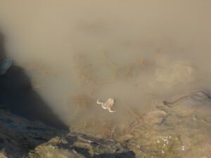
Upstream of its confluence with the Santa Cruz River at A-Mountain, the West Branch Santa Cruz River floodplain ecosystem preserves a rare connection to historical conditions. Half of its current flora of nearly 200 species was also present a century ago. The area provides habitat for local and migratory birds, and locally rare species including the giant spotted whiptail lizard and narrow-mouthed toad.
Until the early 21st century, this post-agricultural area was at risk of further urban development due to its mostly private ownership, wide open space, and proximity to the urban core. In response to a grassroots effort organized by neighbors, biologists, and open space advocates, the available land was acquired by Pima County Regional Flood Control District. The District established the West Branch Santa Cruz River Preserve in 2003 as partial mitigation for a USACE permitted disturbance farther downstream in the watershed.
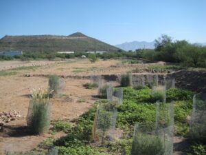
Local stewardship and knowledge have been crucial to understanding the ecosystem’s history, and will continue to play key roles in preserving its unique qualities. The District continues to acquire vacant riparian land in the area and manages the area to best protect and sustainably enhance riparian resources. Active management actions include the delineation of pedestrian and equestrian paths for neighborhood use, invasive species control, erosion repairs, and temporary irrigation in response to drought and the expiration of a historic agricultural irrigation agreement. Where the riparian functions are most at risk due to stream bank failure, the District is phasing the installation of the Bosque Basins Project on the floodplain parallel to eroding river banks. The Bosque Basins Project provides enhancements to riparian resources by addressing erosion risks, installing water harvesting basins and ephemeral toad breeding ponds, and planting a diverse mix of indigenous plant species.